Do you know what geological and hydrogeological natural heritage objects are? Have you ever heard of natural monuments? Aukštaitija will be rich in natural monuments. Most of them are suitable for visiting and are widely visited, others are hidden from the sight of tourists. Therefore, this year we invite you to discover and get to know lesser-known objects. Many of them can now be conveniently reached, because the European Union allocated funds for this.
They have been announced as monuments for a hundred years
The concept of a natural monument was first introduced in the 1920th century. was initially used by the famous German geographer and traveler Alexander Humboldt. Professor Tadas Ivanauskas was one of the first in Lithuania to be interested in natural monuments. We have information that in XNUMX he described old oaks and other trees, suggesting that they be declared natural monuments. He also said that not only trees, but also stones, springs and other objects with scientific, historical and aesthetic value are worthy of this status.
The first natural monuments were announced in 1960, when several hundred trees were declared protected. In subsequent years, trees, stones, springs, outcrops, oases, parks, etc. were declared natural monuments.
A total of 701 natural heritage objects are protected in Lithuania, of which 417 are botanical, 197 geological, 44 hydrogeological, 37 geomorphological, 23 hydrographic and 1 zoological.
Regional parks, state reserves and other assigned territories administered by the Aukštaitija Directorate of Protected Territories occupy a considerable part of Lithuania, so it is not surprising that we protect many different natural heritage objects. In the last year, we visited 53 geological and 17 hydrogeological natural heritage objects - we assessed their condition. We determined that 61 objects are in good condition, 6 are in average condition and 3 are in bad condition.
Stones are giants
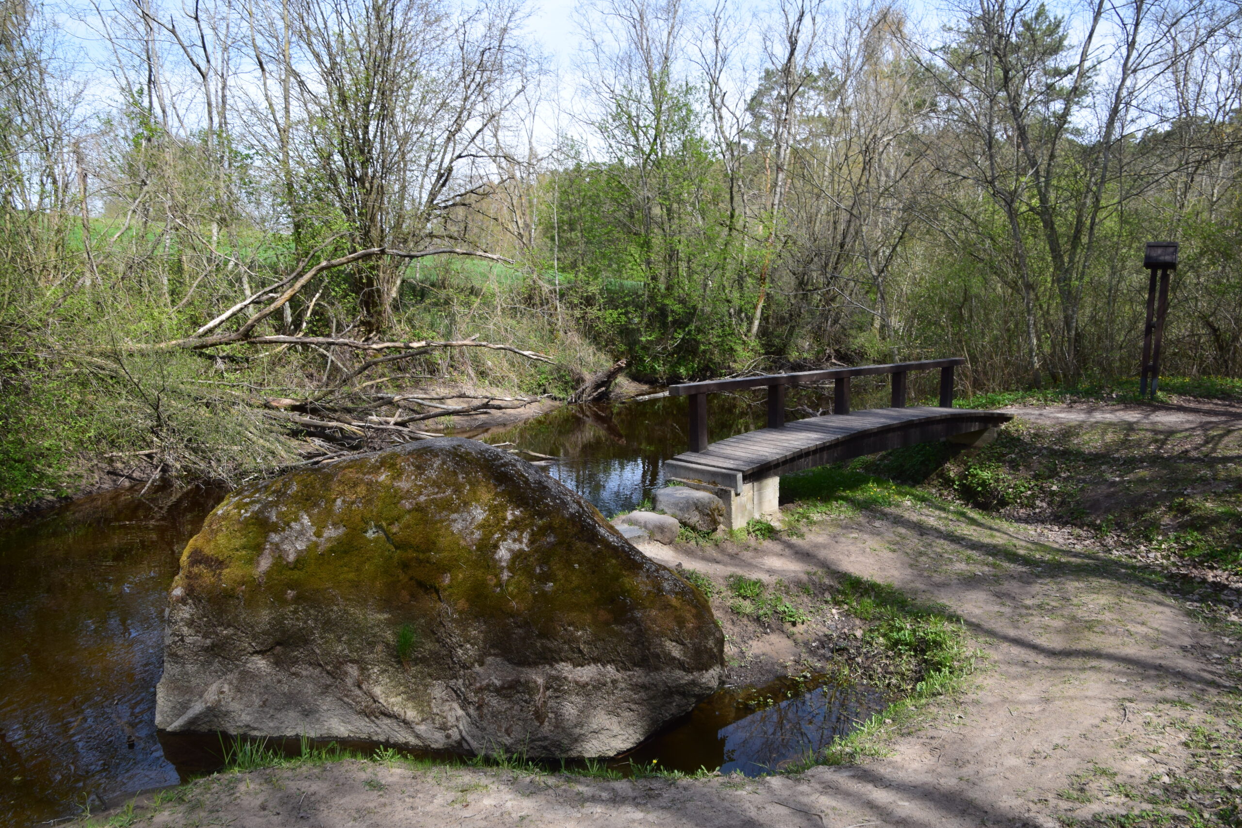
In the Asveja regional park, you must not miss the Jurkiškis stream valley and the Jurkiškis stone lying here.
The Jurkiškis stream valley began to form approximately 10-11 thousand years ago. years. The beginning of the stream was given by the waters that once flowed into the lakes of Berša and Suoselis. It is a very short stream, 1,2 km long. The lower valley of the canyon-type stream is particularly impressive, deep, even up to 18 m deep, carved into the hilly surface. The height difference between Suoselis and Asveja lakes, which are connected by this stream, is 14,5-15 meters. The rapid flow of water and large differences in height create the image of a mountain stream, which is further accentuated by the boulders that lie in its bed. The largest boulder lying in the furrow is protected.
Jurkiškis stone is an elongated oval-shaped boulder of granite-rapakivite composition, which has been lying here since the Ice Age. This boulder is 2 m high, 3 m long, 1,8 m wide, and 8,1 m in circumference. Jurkiškis stone coordinates - 55.074411, 25.415034
In the Krekenava Regional Park, the stone "Rapolas" lies in the bed of the Linkava stream. This weathered stone of cataclased granitogneiss composition was brought here by the last glacier from what is now Scandinavia. The stone protrudes from the stream about 2,5 m, the length of the boulder is 5 m, the circumference is 14,5 m. Rapola coordinates (55.530309, 24.114782)
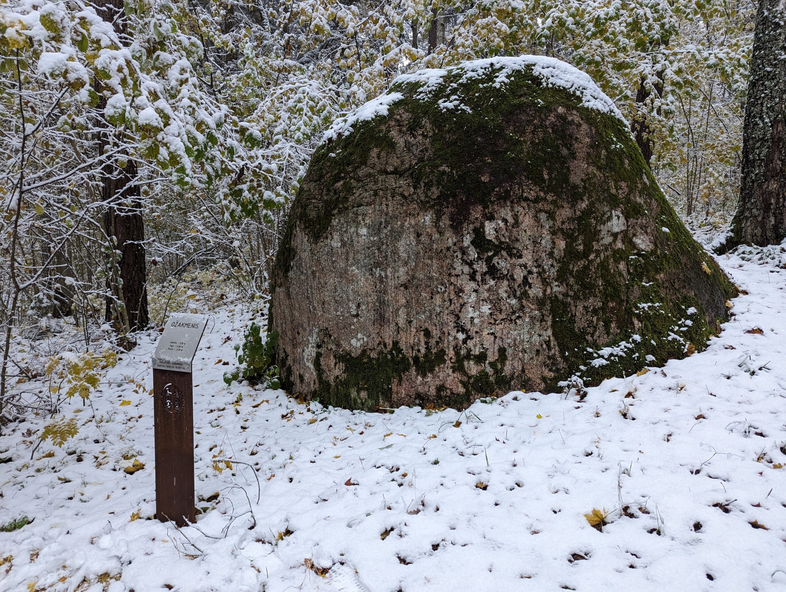
About 20 km outside the Sartai Regional Park, Ožakmenis is found in the Ignatiškis forest. As the presentation tells, a wild goat once jumped on this boulder and thus defended itself from wolves. Since then, the stone has been called Ožakmenis. The boulder is almost 3 m high and 5 m long. length, its perimeter - 13 m, composition - plagiogranite with biotite. Ozhakmenis coordinates (56.013187, 25.678295).
Magic springs
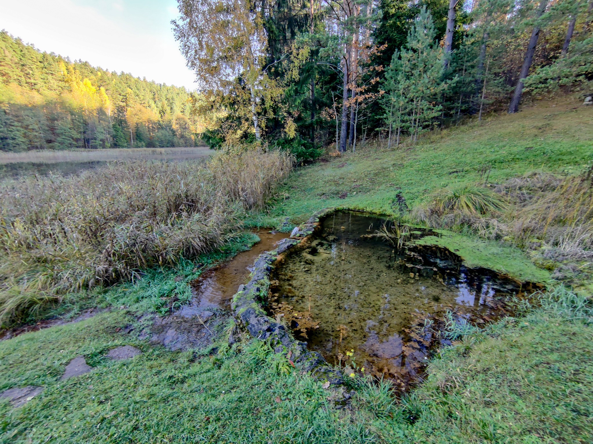
In the regional park of Gražutė, in the town of Antalieptė, the spring of Switzerland rushes as if boiling from the depths of the earth. It is a rising, erosive (verdense) type source. About 1 liter of calcium, magnesium bicarbonate water with a temperature of 7ºC and a total dissolved mineral content of 540 mg/l flows out of the spring per second.
The spring opens on the left bank of Šventoji, two strong and three smaller verdynes are bubbling in the spring, raising sand particles in eddies. It is said about the source that Šventoji flows in the east-northeast direction. Prof. In the books of Vykintas Vaitkevičius, we can find such stories: "There is a spring in Žioty, which was considered miraculous in the past. People used to wash their face and eyes. For healing, they threw money into the well." "The holy spring, where people cure all kinds of diseases and tie them on threads of trees; whoever touches those threads will get sick." "There are threads tied to that spring on various trees. We cut those threads, but after a few days they came back. Later we found out that that spring is magical, a guide against goiter (joint pain), eye diseases and others."
Swiss source coordinates (55.652712, 25.876367)
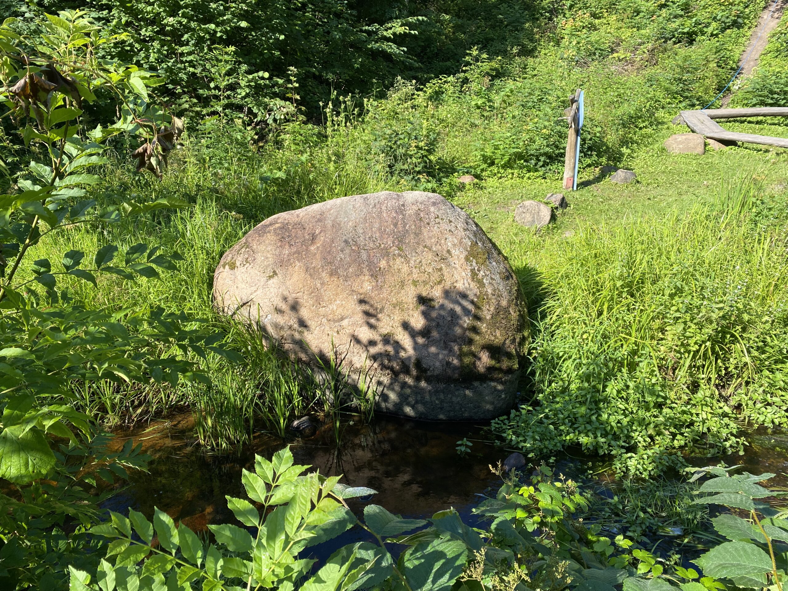
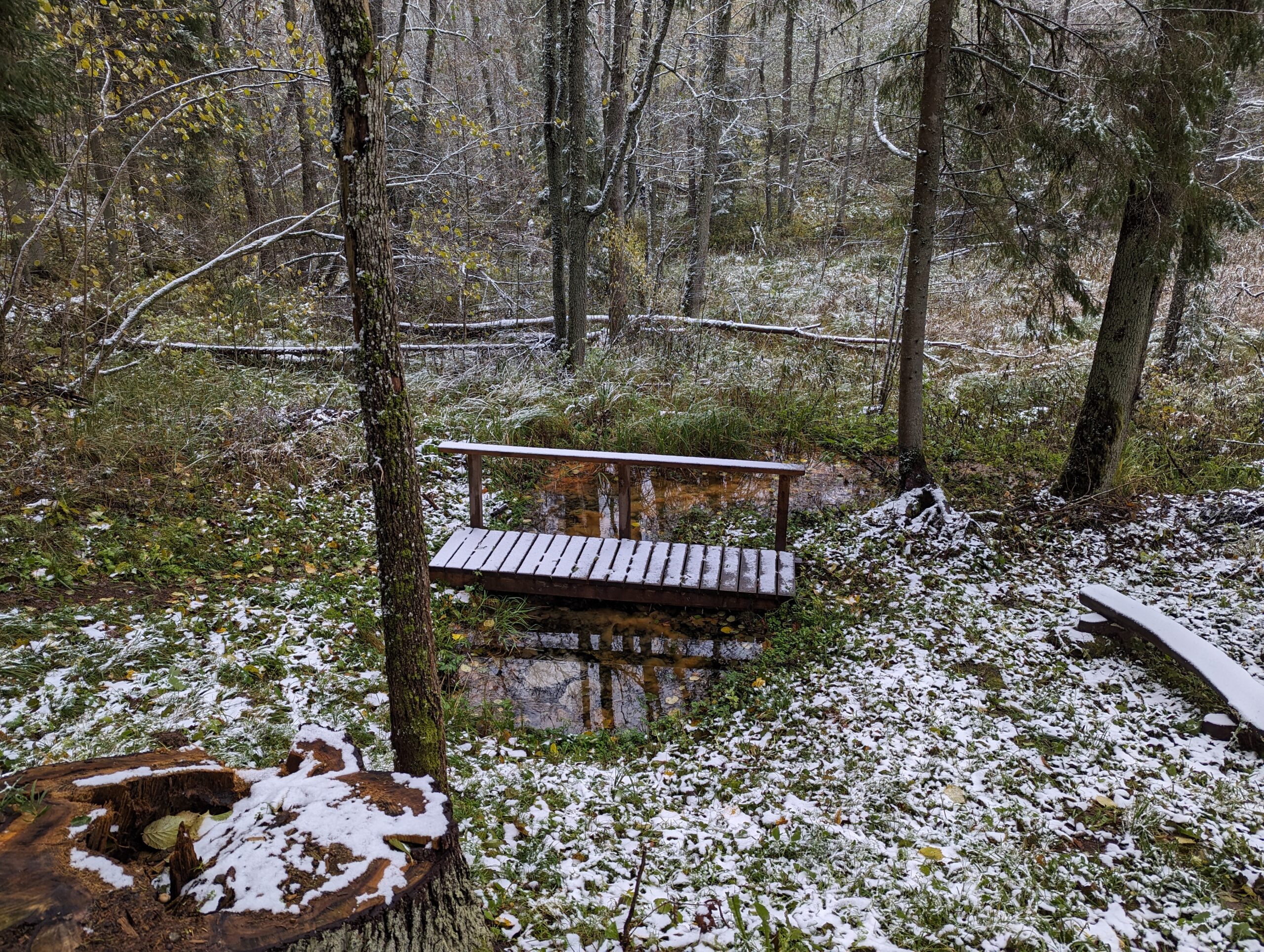
The best-known hydrogeological natural heritage object in the Sirvėta Regional Park is Lino's weir. This protected natural monument of republican significance is important both from a natural and historical-mythological point of view. The spring and its surroundings begin the chain of protected natural and cultural heritage objects and unique territories in terms of landscape in the Sirvėta landscape reserve. This entire area is surrounded by legends and legends, just like the spring itself. For the local residents, "Lino verdene" has been a special, sacred place for a long time. About 50 years ago, there was a hut on the slope above Lino verdene, where there is a relatively flat place, where some woman sold spring water for money. In this way, she saved so much money that she used it to buy a nice house somewhere. The spring has been maintained by an old amateur fisherman, the son of Bavainiškės owner B. Česukėnas, but the spring was dammed long before.
People used spring water to treat eyes, scabies, and superficial skin wounds. "They used to carry bags and donate some money there, the "memories" of the olden days were still what they were. They say that they were donating - they were throwing money into that well, maybe for the sake of some life or health". "Kapeik used to add rusk sometimes. He cures all diseases" - these stories were recorded by prof. V. Vaitkevičius.
The source is called verden, because it is of a rising type, 5,8 liters of calcium, magnesium hydrocarbonate, sulfate water flows out of it per second, the total amount of dissolved mineral substances is 421 mg/l. The spring does not dry up in summer and does not freeze in winter, as the water temperature fluctuates around 7,7 ºC. The resource for the visit was adapted to the funds provided by the European Union.
Coordinates of Lino verde (55.163051, 26.247940).
Outcrops, caves….
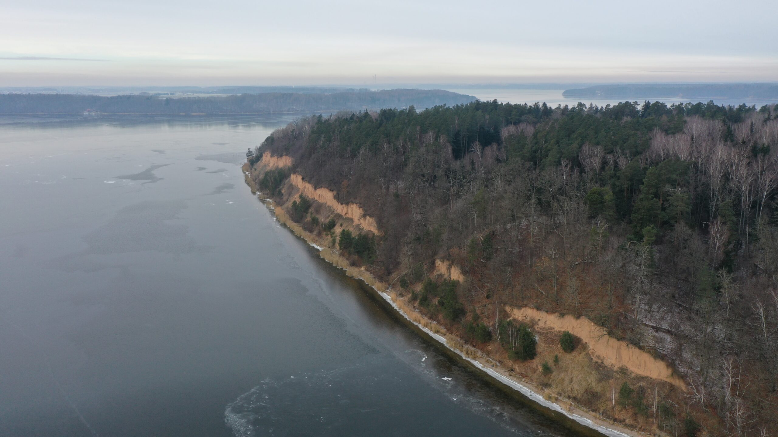
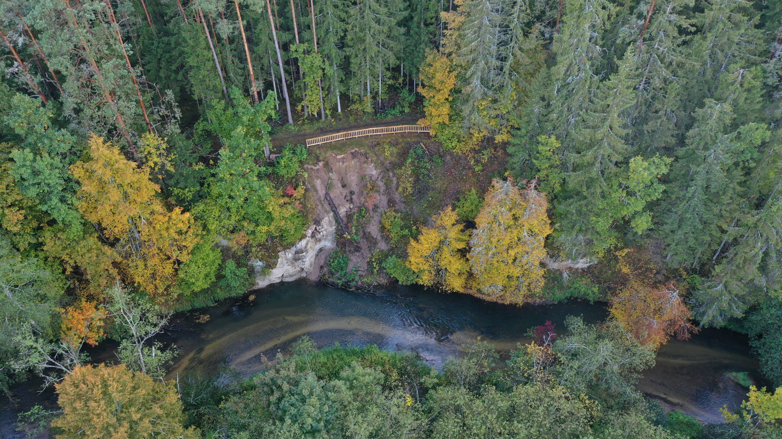
In the Kaunas Lagoon Regional Park, in the scenic and steep, sometimes 20-40 m high, Kaunas Lagoon shoreline areas, often formed by landslides and erosion, sand layers and sediments laid down during the interglacial are exposed. One of the longest in the territory of the regional park is the Gastilionii outcrop, stretching 600 m along the shore of the Kaunas lagoon and reaching a height of 29 m. The 90-degree exposure reveals moraines from two ice ages, separated by layers of sand laid down during the interglacial. Fossils are also found here - petrified, charred, mummified or frozen remains of organisms, their prints or traces of activity in the layers of the Earth. The exposure is best viewed by boat in the lagoon.
Coordinates of Gastilioni outcrop (54.871528, 24.150660).
In the Anykščiai Regional Park, the Virinta River intensively erodes and washes its rocky bank as it meanders, one of such places is the Vildžiūnai exposure. The 10-m-high and 50-m-long cliff overlooks the quarter and 300 million. years of Devonian sandy sediments. A wall of cemented whitish sand with niches simply descends into the river bed underwater. The outcrop is easily accessible by outdoor roads that lead from the villages of Vildžiūnai and Pakalnii. The outcrop is clearly visible when swimming along the one-day (16 km) route "Virintos meanderomis" prepared by the staff of the Anykščiai regional park group.
Coordinates of Vildžiūnai outcrop (55.452966, 25.010128).
Biržai Regional Park is not short of geological objects. One of the most interesting ones is Lapės ola, which opened about 70 years ago. It was named so by the geologist Vytautas Narbutos, who explored the Biržai region, because foxes liked the sinkhole, and they probably settled here. The diameter of the fox cave is 17,2 m, width 16 m, depth 7,4 m. The sinkhole is unique because Devonian gypsum and dolomite layers are exposed in the walls. Some of the ingots are torn apart and tumble chaotically to the bottom of the sinkhole. It is believed that cracks to the underground caves are also hidden under these blocks, because the water never stagnates in Lapės cave. Thanks to the funds of the European Union, it is now not only convenient, but also safe for the curious to visit here.
Fox cave coordinates (56.210278, 24.691631)