
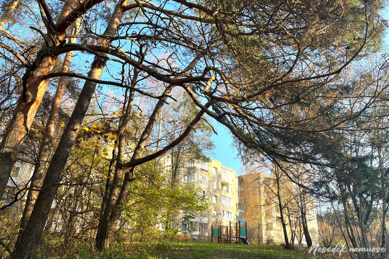
A real mix of the city and green areas awaits on section VII of the path around Vilnius. It begins at the head of Gelvonai, where the newly emerged apartment building framed Šeškinė's oasis even more. The construction fence and the mud of the construction site, which is worse than swamps, force you to deviate from the route for a while. A small obstacle of trees and bushes has been overcome and Šeškinė's walls are left behind. In front - Šeškinės oz.
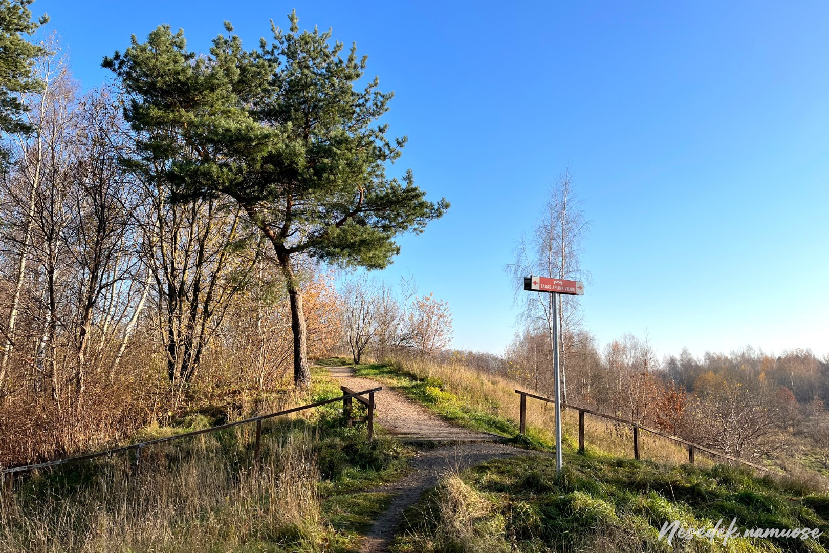

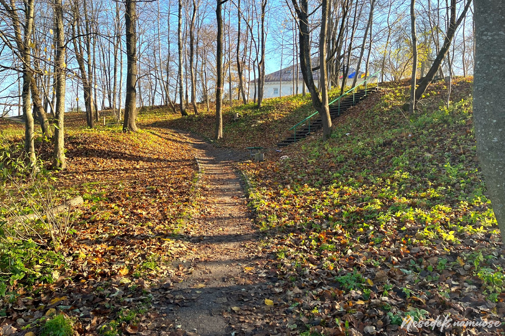
This is the first green zone in this section, in the center of which stretches an almost kilometer-long ridge of glacial origin - Šeškinė oz. Then, when the glaciers covering Vilnius began to melt, huge streams of water flowed through their cracks. It was they who brought a large amount of gravel, pebbles and other sediments in these cracks, the ridge formed by which is named ozu. It has changed from its original appearance, as it suffered during World War II and the post-war years. The ridge of gravel brought down by melting glacial waters served as a gravel quarry for the Soviet authorities. Only after it was declared a Natural Monument did the management and protection of Šeškinė Oza begin. One of the established trails also winds over the top of the lake, but the route around Vilnius leads along its edge.

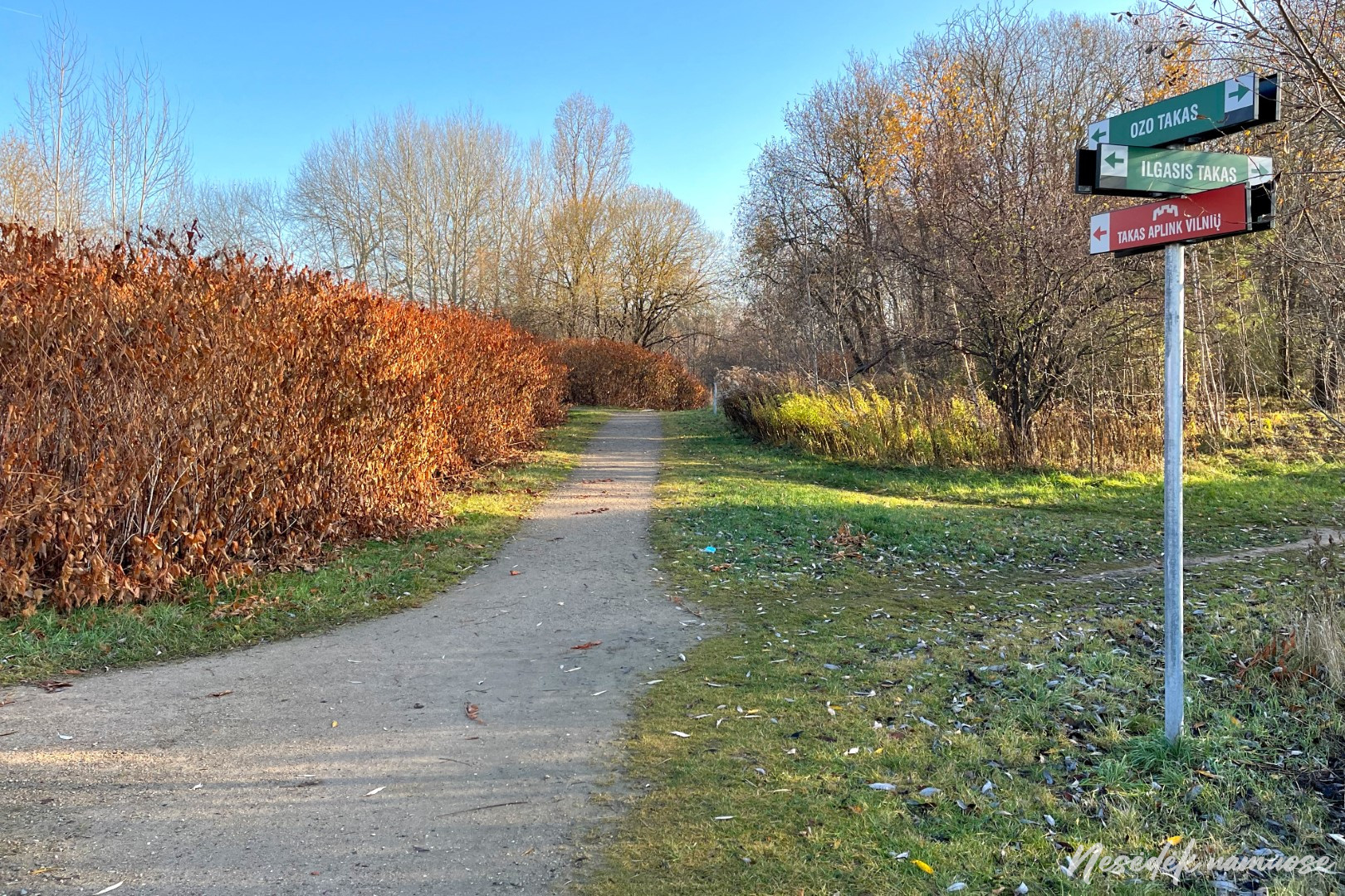
About a kilometer away trail around Vilnius crosses the hill and leads to a small lake. Šeškiuk is a water body of glacial origin, around which residents of the surrounding areas like to spend their free time. Here you will meet people at all times of the year, the routes of even several paths cross here - Oz, Ilgojo and the path around Vilnius. After going around Oza and leaving Šeškiuk on the side, the route turns again towards Šeškina apartment buildings, in the yards of which the markings suddenly disappear. It seems that some of the markings are disappearing due to miscreants as well. A missing arrow is not the worst option, it is much more unpleasant to be pulled in the wrong direction, which is indicated by a maliciously twisted arrow or an overhanging ribbon. There were three or four such places along the entire route, but timely observation helped to quickly get back on the right track.
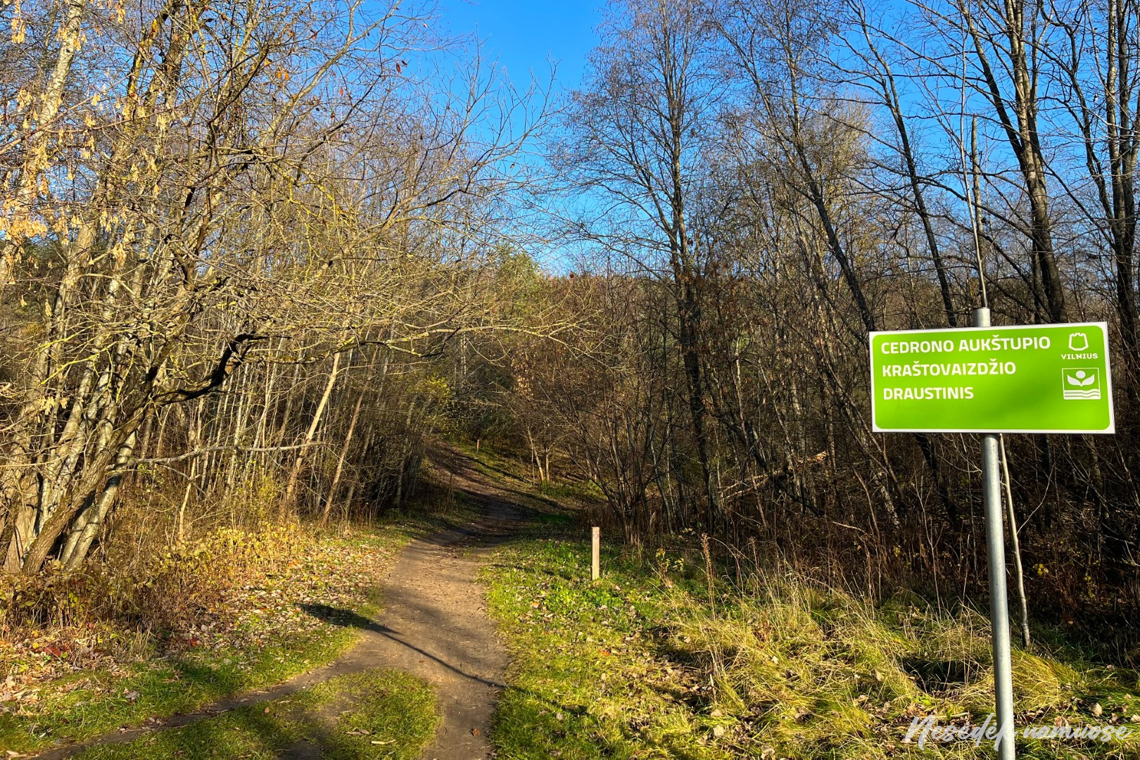
The route continues to the green area between Fabijoniškės and Baltupiės, called Fabijoniškės forest park on the maps. This place is distinguished by an expressive and hilly surface and a deep valley through which the Cedron stream rushes to Neris. Here, its headwaters, and at the same time the protected area, is the Upper Cedron Landscape Reserve. The stream is almost invisible here, but you will definitely be able to feel the steepness of its valley slopes.
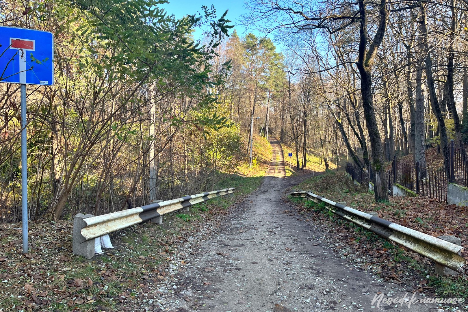
Fabijoniškių and Jomanto forest parks are separated by Baltupiai and the busy Geležinio Vilko street. There are few places on the route where you have to cross the street at a traffic-controlled intersection, but this is one of them. About a kilometer away, you will have to cross Ateitis street at the same intersection, but until then you will have to cross the Jomanto forest park. In ancient times, there was a manor here, but neither the place is clear nor any evidence left. Only the name of the park was inherited from the owner. The route at the bottom of the deep horn goes through the park in a northerly direction. Such green areas are called biological corridors by naturalists because they help birds and insects to migrate. Such biological corridors and paths around Vilnius are perfect for the Vilnius route - walking along nature trails is much more pleasant than walking along sidewalks.
Sidewalks cannot be avoided and the next section leads through Jerusalem. I can feel myself starting to look for green areas around me and wonder if the route could have been diverted differently? This is where I catch myself in the arm appreciating someone else's work instead of observing the surroundings to enjoy the walk. Maybe this is a typical feature of our nation, where there are more basketball coaches than those who teach the game? The truth is that on a 100 kilometer road there are all kinds of thoughts about everything. Sometimes you are so immersed in your thoughts that everything around you seems to be in the background. It's good that the "autopilot" reliably guides you along the marked route. And only when the marking disappears, someone turns off the "autopilot" and sends a clear signal - where to go next?
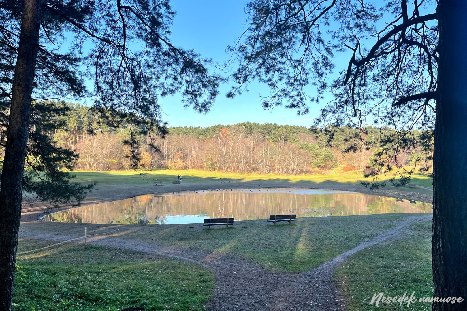
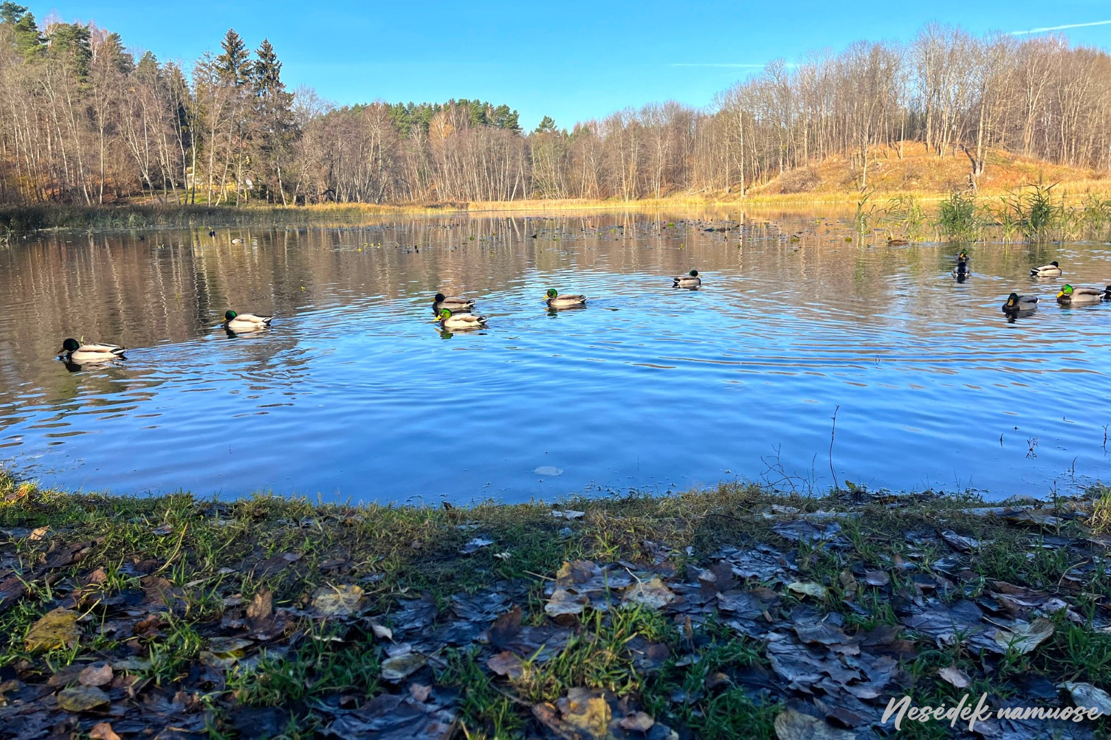
Next is another park - Jerusalem pond. Maybe every green space in Vilnius is called a park? It doesn't matter, the most important thing is that there are many green areas and Vilnius is one of the "greenest" cities in the world. The route leads directly to the Jerusalem pool. The environment doesn't exactly resemble a park, but that should change soon. There will be walking paths, rest, play and leisure areas - the park is planned to be renovated. A 2-kilometer-long educational trail should extend around the pond, as this area is characterized by biodiversity, valuable from an aesthetic point of view. I will definitely visit, and now I am turning towards Verkii without stopping.
An ambulance passes by the Santariški ring with its beacons on. The driver is wearing additional protective measures, so it is likely that the body of the person being transported is fighting the virus. Urgent help is needed and the doctors will do everything to make him well, regardless of whether the patient believes what is wrong with him or not. I am happy that I can walk on a path around Vilnius instead of lying down and breathing oxygen in one of the wards. I wish health to those who are sick and sanity to those who have not yet fallen ill, and I walk along the street of Zhaliių ežeri, where the roofs of the Verkių manor buildings can already be seen in the distance.

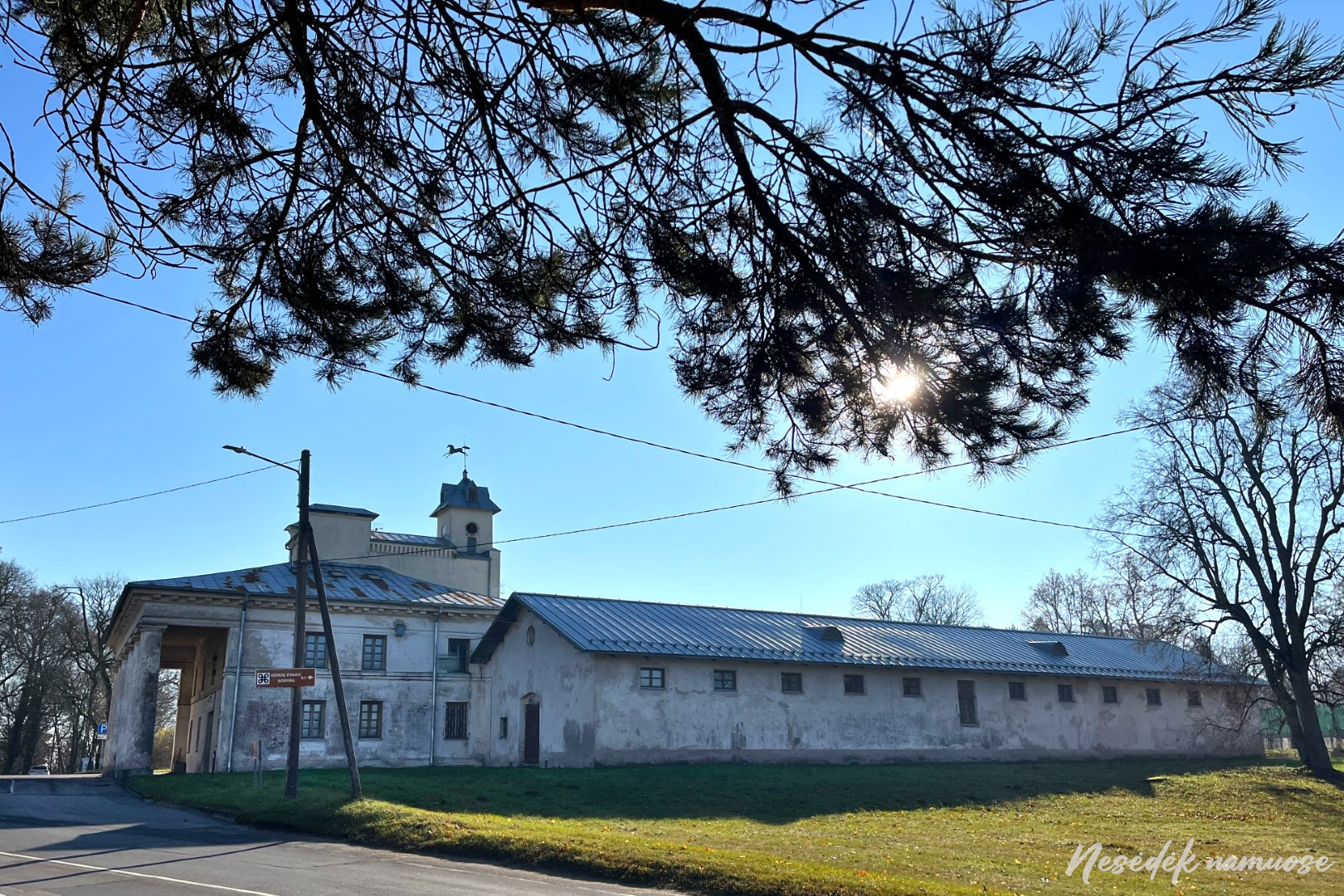
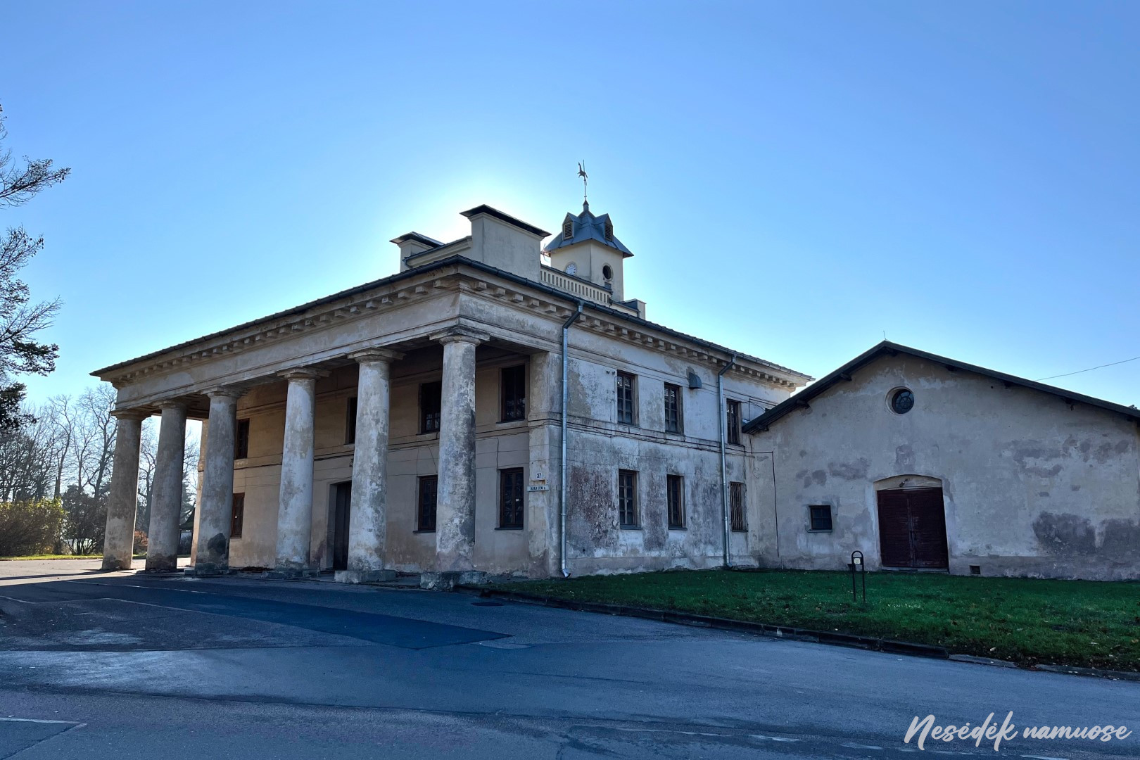
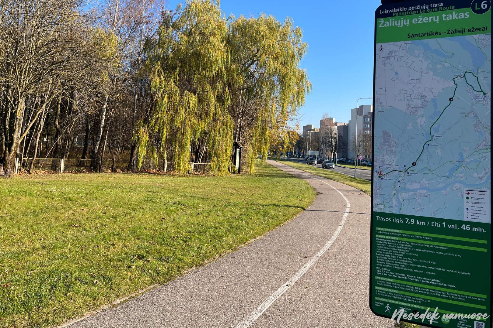
The route leads along the busy Žaliių Lakes Street, but pedestrian and cyclist traffic is no less busy. Both the Verkių manor homestead and the forest trails that start near it attract crowds of Vilnius residents in good weather. The territory of Verkių Regional Park begins. The following section will be the longest on the trail around Vilnius and it will all stretch through the forests of this regional park. The colonnade of Verkiau manor houses marks the end of section VII and the beginning of the following section. The place is well chosen - it is on the other side of the road public transport stop, so it is convenient for both those who have their own transport and those who use public transport. This will not be the end for me, but a rest stop. Walking is said to be one of the best forms of meditation. Buddhist monks walk for several hours in the mountains trying to feel nature, to smell the slightest smell or barely audible sound. Awareness and attentiveness improve, we become more alert and sharper. You just have to go, breathe, observe, focus. Buddhists have mountains, and we have Vilnius, all you have to do is leave the sofa and go.
