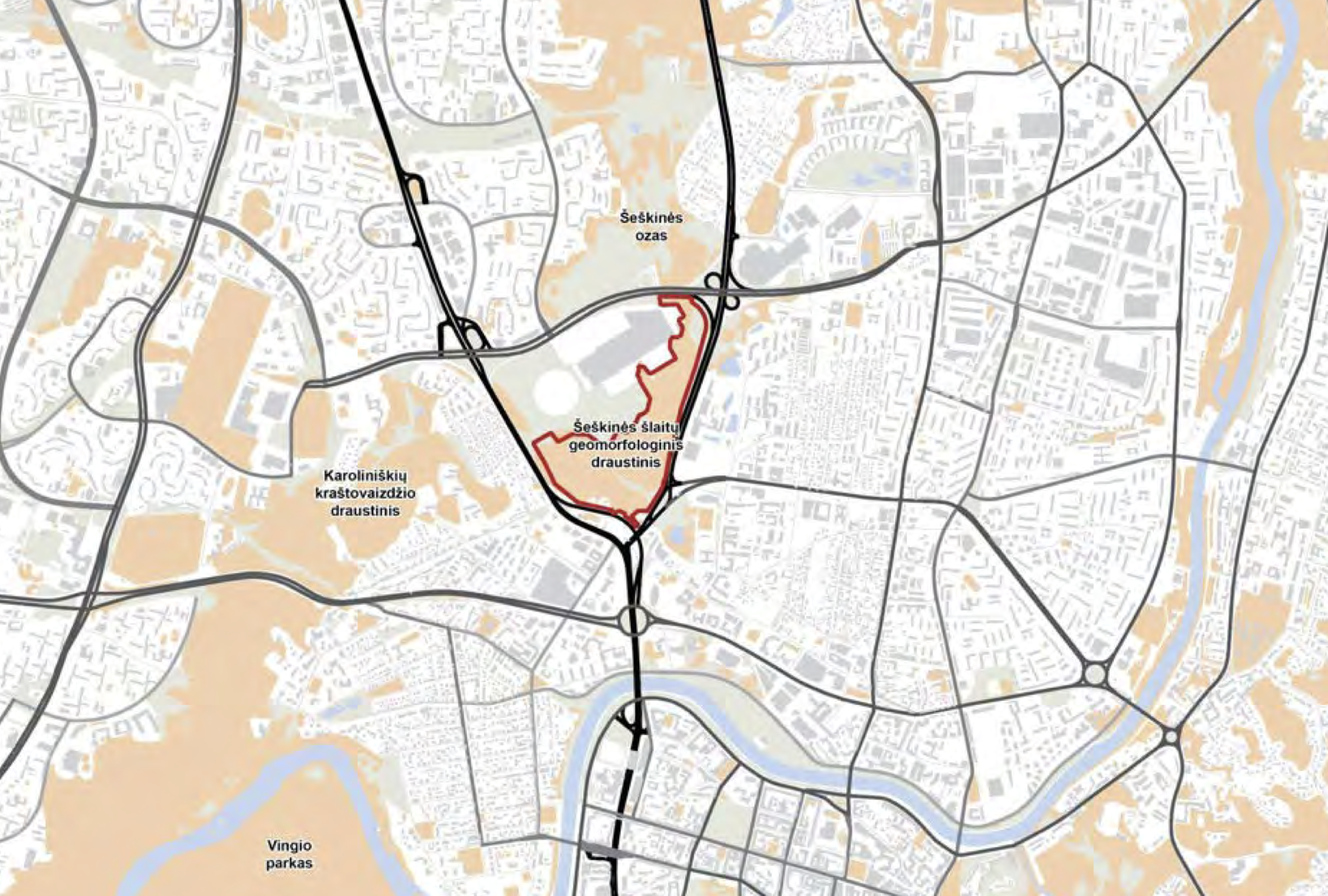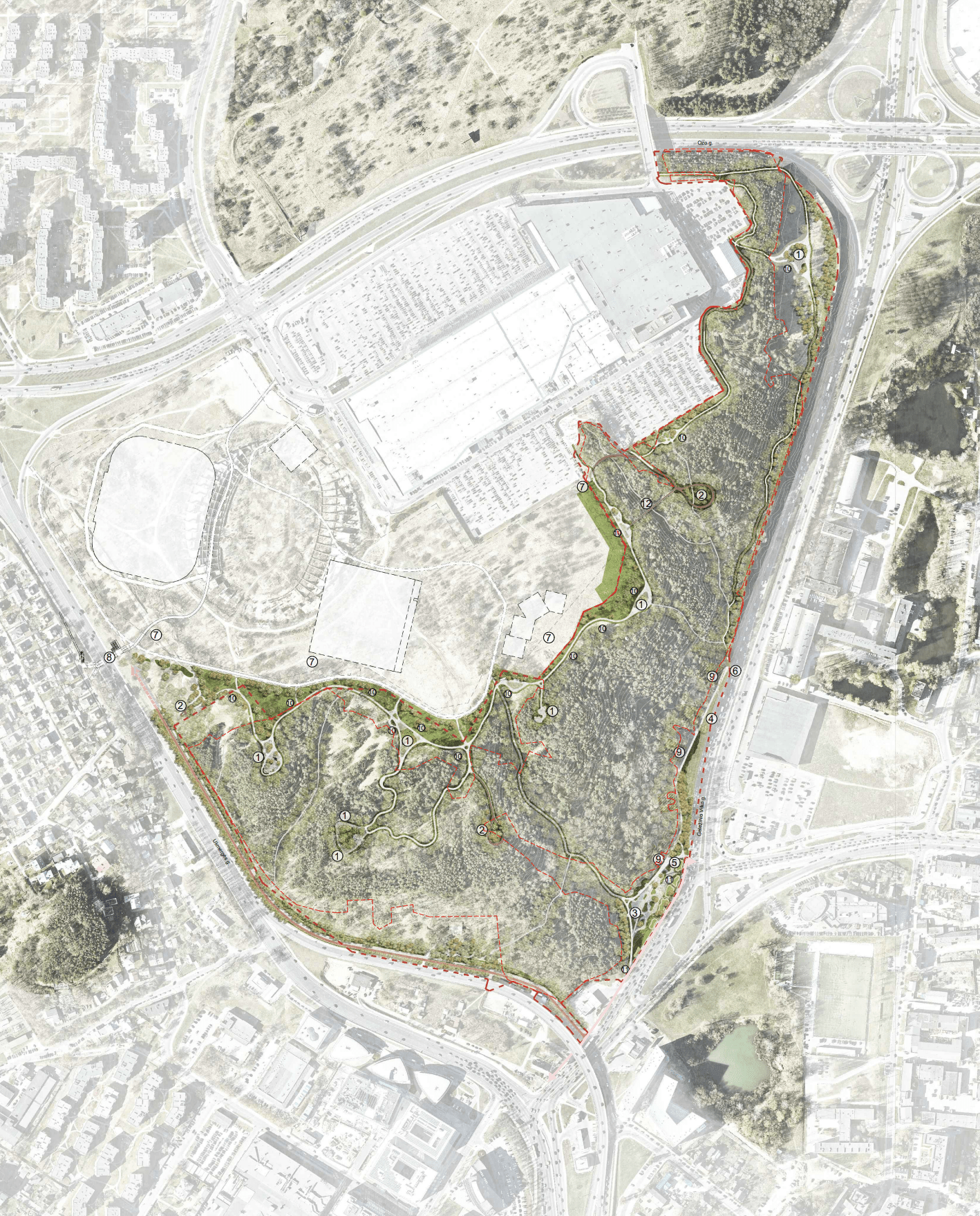
A couple of years ago, we wrote about the fact that in the Šeškinė nature reserve, next to it, construction is ongoing National Stadium, a new public space - a park - is planned for city residents and guests. We will remind you that Vilnius city municipalities and the competition for the adaptation of the slopes of Šeškina initiated by the Lithuanian Architects Union was won by the project of the team of architects, urban planners and landscape architects of MB "Bauland" (D. Baltrušaitis, A. Dailidaitė, P. Kliučininkas, J. Šerpetauskytė) - Mammut Park. The updated design proposals for the management of the territory of the Šeškina slopes geomorphological reserve with accesses and other facilities located in the territory will be presented for public discussion with the public.
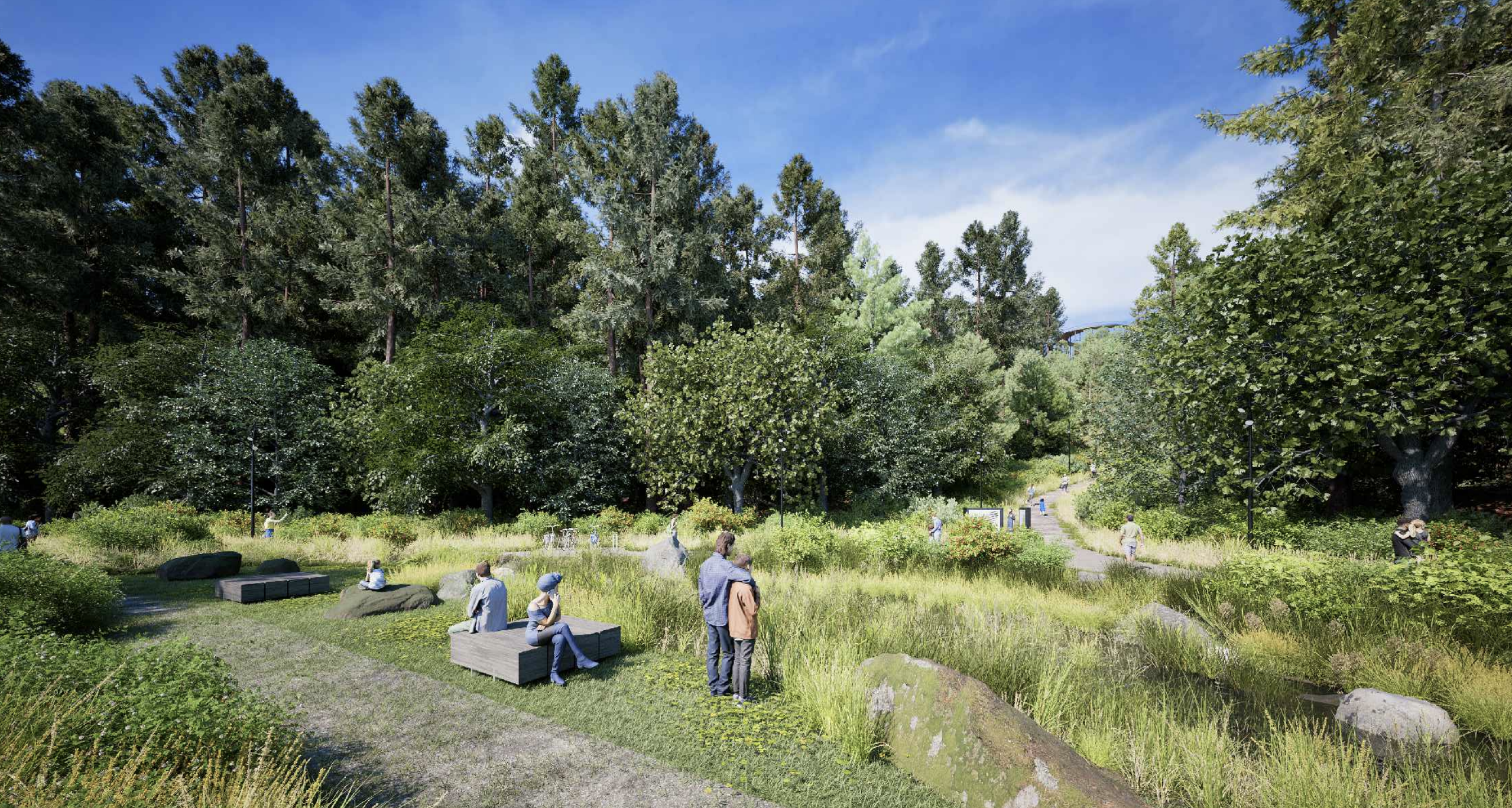
In the design proposals, it is mentioned that 4 mammoth pastures of various sizes and functions and 7 recreational (educational) spaces would be formed. These recreational areas would be spread throughout the park. These spaces are recreational-educational spaces that encourage you to get closer to nature and through active movement and other senses to understand the environment and the topics discussed on the route.
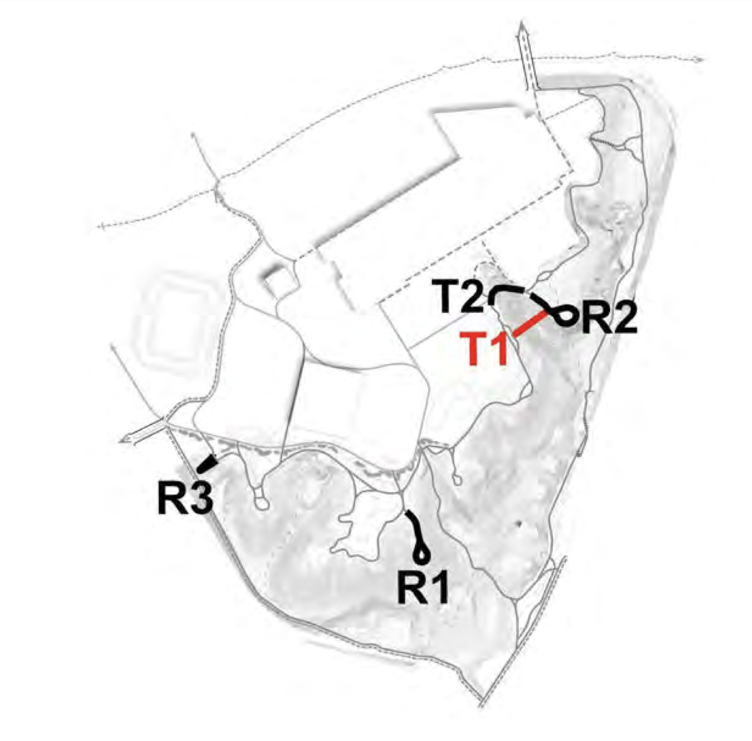
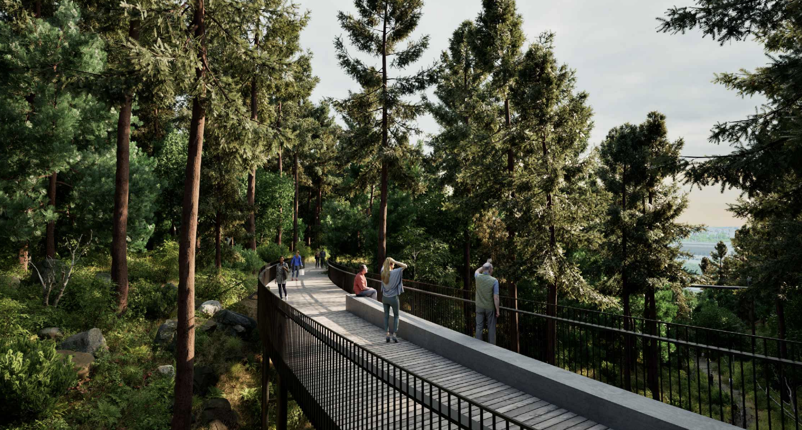
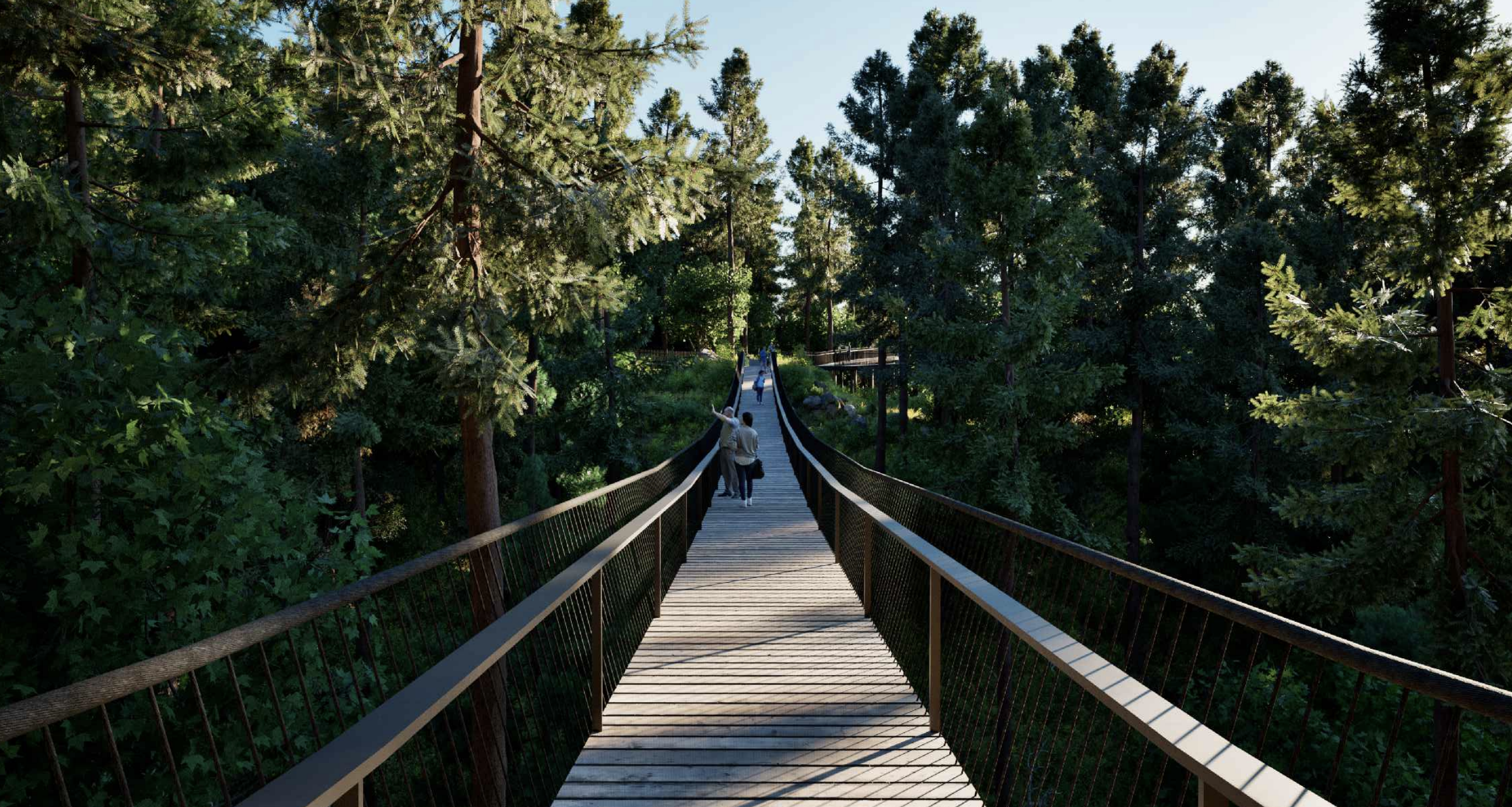
In the scope of Mammoth Park's design proposals, engineering structures for other purposes are foreseen: R1 observation point, R2 observation point, T1 pedestrian bridge, T2 elevated pedestrian path. An engineering structure of another purpose is planned outside the territory of the planned park - the R3 sight.
The park will have five types of trails
The design proposals indicate that 5 types of paths are planned to be installed according to the functional significance and materiality of the paths:
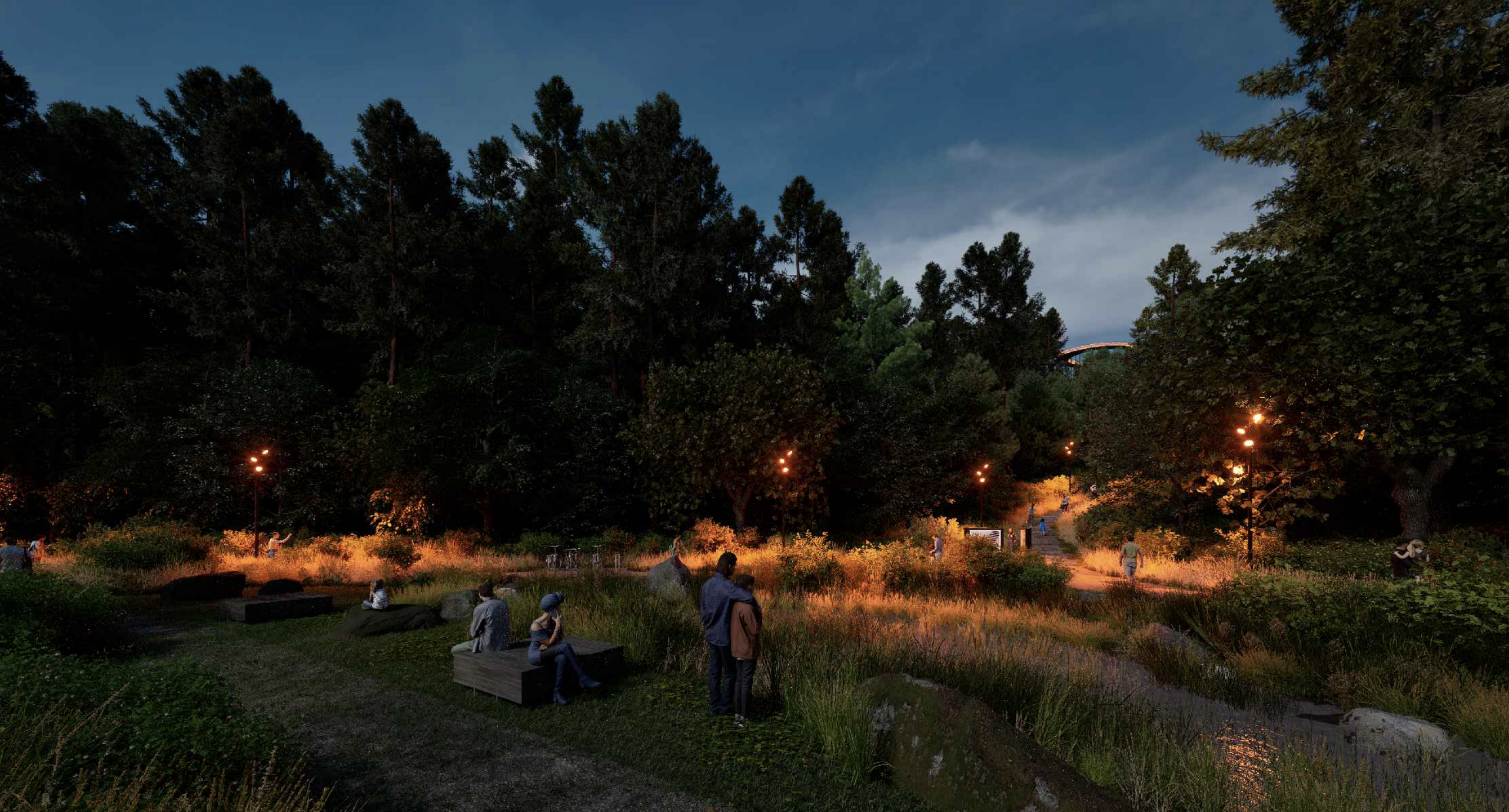
Mammoth Trails - functional/themed park trails. The functional paths are the fastest passage through the Mammoth Park, the paths connect the surrounding districts and the future multifunctional complex of health, education, education, culture and employment. Most of the functional trails are located in the places of existing trails, therefore, during the installation of the trails, trees and bushes will be damaged as little as possible, and the existing reserve terrain will be respected. The width of the path is at least 2,25 m. The coating is a crushed stone mixture. Plants are managed at a distance of about 5 m from the path in both directions. The lights will be installed along the path.
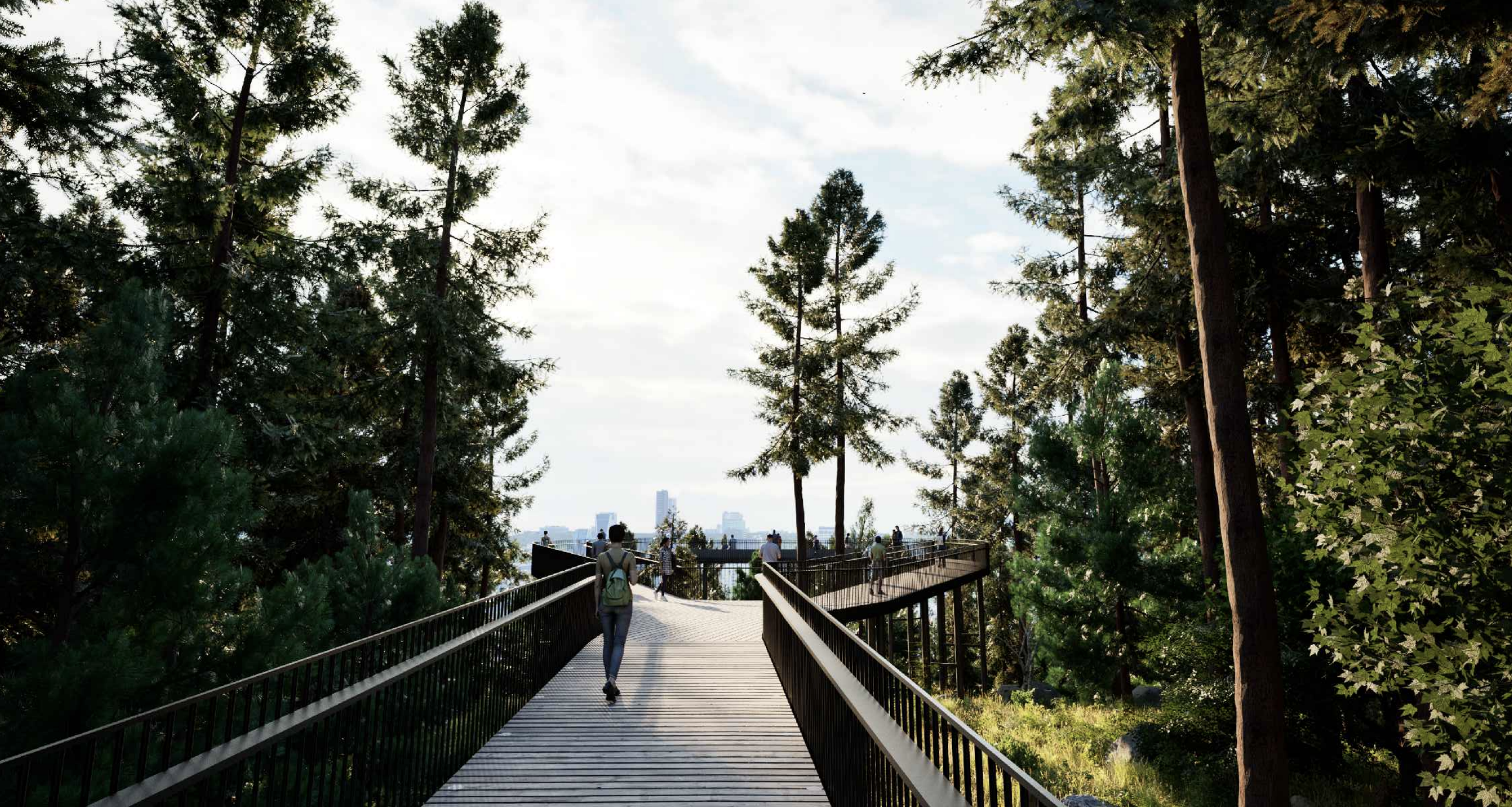
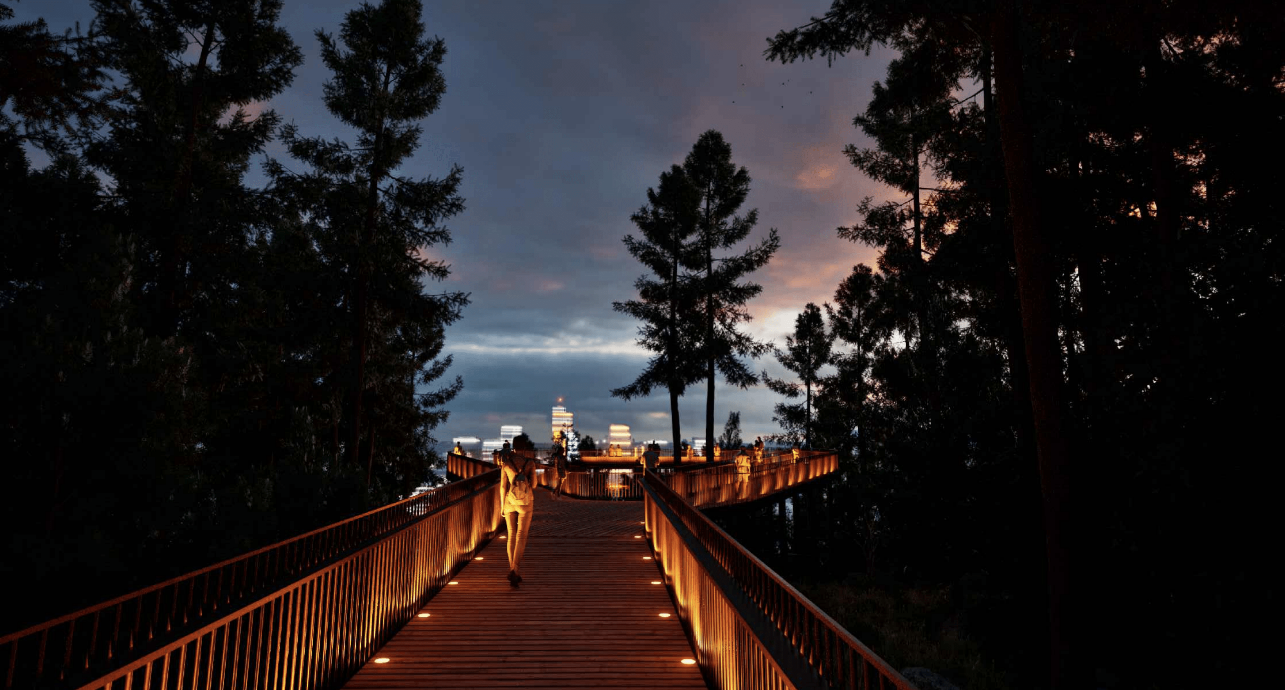
Raised wooden walkways with a foundation. In the sections of the main path, where the slope of the existing path does not meet universal design standards, the path is designed with raised structures with a foundation and wooden covering. The chosen principle of the path unites with the sights of the park, allows you to overcome the barriers created by the existing terrain - steep slopes are overcome, the valley is bypassed. A thermal wood covering is planned, the vegetation would be managed at a distance of about 5 m from the path in both directions. Lighting would be installed on the track itself.
Cycling and hiking trails on Ukmergė street. A two-way section of the bicycle path is planned Ukmergė st., on the west side of Mammoth Park. The beginning of the section is considered to be Geležinio Vilko St., near the intersection with Ukmergės St. The section connects with the pedestrian and cyclist overpass designed by another project, located at Ukmergės st. A 2,25 m footpath is planned next to the bicycle path. The width of the bicycle path is 3-3,5 m, the surface is red brick-colored asphalt concrete (bicycle path), concrete tiles (pedestrian path). Street lights will be installed near the bike path.
Forest trails (green trail) - additional trails. About 1,20 - 1,50m wide additional paths and they will connect the functional paths to the circular park path system. The name of forest trails indicates that these trails are located in the places of existing forest trails, they are more remote, sometimes more difficult to reach and therefore encourage a more diverse knowledge of the natural environment. A cover of gravel and soil mixture is expected. Within a radius of five meters from the path, vegetation would be cleared and additional lighting is not planned;
Existing tracks ("Mamutuks" tracks). The existing tracks (width about 0,50-0,80m) of mamutuks are of an educational nature, they allow visitors to get acquainted with the geology of the Mammoth Park, they also overcome the forested slopes of the territory and allow them to wander to more remote parts of the park. The cover would be soil, sometimes reinforced with stones or tree stumps. The greenery in this area would not be additionally managed, no additional lighting would be installed.
It is recommended to install a third viewing platform, an ecoduct and an underground passage in the park
The design proposals indicate that the Mammoth Park concept envisages the installation of a western lookout point (hereinafter lookout point R3), which is located outside the territory of the Mammoth Park area. The observatory would open views towards the Neris valley and the Karoliniškii landscape reserve, and would be easily accessible from Ukmergė st. pedestrian bridge (under construction) and would be an integral part of the park's trail system.
"In order to strengthen the natural framework, the possibility of creating an ecoduct (overpass for animal migration) connection between Šeškina Oose and the geomorphological reserve is identified, through which both large and small animals of the park could move safely," the project proposals state.
Also, in the future perspective, it is proposed to install an underground pedestrian crossing under Geležinii Vilkas Street, thus connecting Mammoth Park and the Japanese Garden, and at the same time, it would help to improve accessibility in the future by implementing the Šeškinės bunker complex with the Šnipiškii microdistrict.
The park is planned to open in 2029
At the end of 2022, it was also announced that the "Mammoth Park" in the Šeškina Nature Reserve, which will introduce the finds of mammoths and the extent of the Ice Age, should be opened in 2029, and 13 million was planned to be allocated for its construction at that time. euros.
Technical parameters of the project
- The address of the planned object is Šeškina geomorphological reserve;
- The area of the plot is 321 square meters2;
- Project developer/customer - Vilnius city municipality;
- Design proposals were prepared by UAB "Aplan" and MB "Bauland". Project manager Arūnas Andrašiūnas;